Our Working Waterfronts
Connecting Whatcom to the World
Our working waterfronts began as early as humans began gathering food from the shores and sea, transporting goods and cargo across it, and enjoying recreation upon it. These stories go back to the first people who lived here and were sustained by the waterfronts that stretch along our coast, and continue through to our modern times as a tapestry of our interactions with the oceans, seas, and bays that surround our region.
Modern day Whatcom and the Puget Sound region have several key areas of the working waterfront that are growing, changing and continuing the story of our work on, in, and around the water.
(Banner Credit: Steve Hardin)
The Bellingham Shipping Terminal
Our Gateway to the Global Economy
The Port of Bellingham has put forward policies and plans to ensure our modern working waterfronts. The commercial shipping terminal near downtown is one such location on our waterfront that the Port continues to develop for greater trade, commerce and jobs. The terminal can bring in over $1M in revenue just on one contract - and can run several contracts concurrently. At full capacity, the Bellingham Shipping Terminal could bring in as much as $12-13 Million in revenue each year to the Port.
Shipping Terminals are permanent pieces of infrastructure, similar to an airport, where goods and people move through at various hours of the day, as part of United States Marine Highway System, a federal designation aimed to help encourage the use of our waterways and provide needed infrastructure for national defense. Transporting goods via barge and ship has been proven to be the most fuel-efficient form of transportation, decreasing truck and semi traffic on roads, cutting emissions via road transport by almost nine times, and halving emissions that would be incurred by rail transport. Ships call the terminal for loading/unloading dependent upon many factors outside of our county as part of this vast national and international network of commerce. Ships coordinate with Longshoremen and operational Port staff, who work to have the terminal available at any time of day or night to accommodate a ship's schedule of port calls. To find out more about the terminal, follow the link below:
The Bellingham Cruise Terminal
The Bellingham Cruise Terminal in Fairhaven features ferry and cruise ship docks, an events space, shops, restaurants and the Whatcom Maritime Heritage Museum.
Located just adjacent to the Fairhaven Industrial Marine Complex and active shipyard, the terminal is a connectiont not only to the northern routes of the Alaskan Marine Highway system, but to Amtrak services, pleasure-cruising and whale-watching businesses, and Bellingham's own tallship, the Schooner Zodiac.
Squalicum Harbor
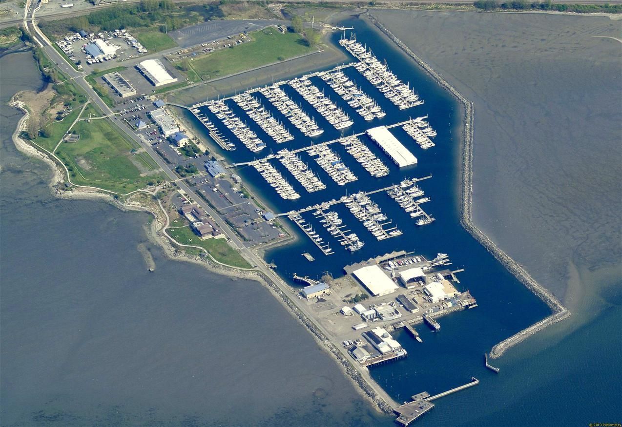
Squalicum Harbor features recreational and commercial moorage, and some visitor moorage. Situated along Roeder Avenue in Bellingham, the jettied harbor is protected, and houses several businesses, restaurants and other amenities on site. Over 1,400 vessels call this harbor home.
Blaine Harbor & Industrial Area
Just south of the Peace Arch and Port of Entry for Canada, Blaine Harbor features recreational and commercial moorage, restaurants, a shipyard, commercial seafood companies, and a myriad of other businesses.
C Street Trades
Our Waterfronts at Work
The trades businesses located at the 'C' Street site along Roeder avenue are a collection of thriving businesses that service vessels, barges, ships, and boats of all kinds.
The Port of Bellingham purchased the area from the city to help preserve the waterfront trades that rely on access to the water, in order to practice their trades.
Today, the C Street Trades, which host over 100 contractors and the Landings on Colony Wharf, bring in around $700,000 in revenue the businesses located there a year, which support living-wage jobs paying $50/hr as a base, with most paying more.
The Aerated Settling Basin, to which stormwater runoff from the logpond/laydown area across the waterway is pumped for containment, is set for redevelopment. The current planning, and reference material for those plans, can be found via the link below:
Interactive Working Waterfront Timeline & Map
The history of Bellingham and Whatcom from a more recent era provides us a fascinating look into the evolution of our waterfront economy, heritage and ever-changing shorelines and region. Anna Booker, History Professor at Whatcom Community College, and her students have assembled a fascinating interactive map that follows the more recent history of our region’s shores via the maps and markers that were etched, drawn and printed throughout the last 100 years. This interactive look into the history of Whatcom County is yet another example of how our waterfronts connect the stories of the past in our region, to our present-day lives.
Cascadia Daily News' "Working Waterfronts" - History of Bellingham Bay
Cascadia Daily News' ongoing 'Working Waterfront Series' Pt. 2 - A brief overview of the history of our working waterfronts can be viewed here:


